Tai Tam Reservoir Road – Best Family Walk – HK Island Hiking
EscapeWithAnnualLeave contains affiliate links. We may receive compensation at no extra cost to you. See our Disclosure Policy for more information.
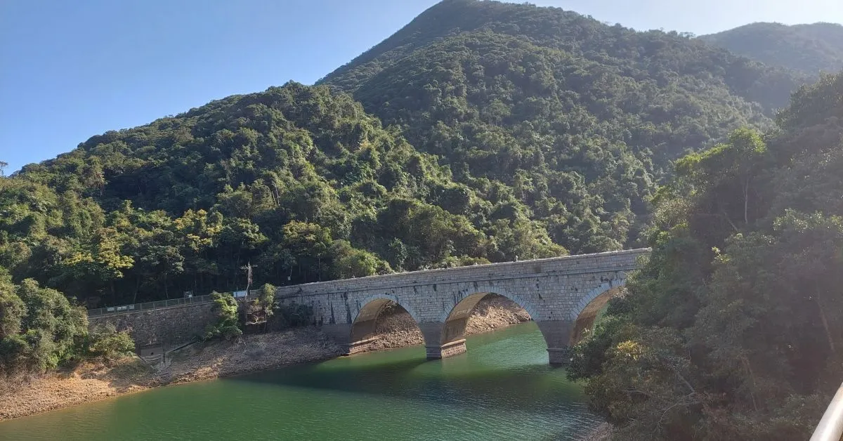
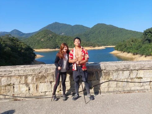
Tai Tam Reservoir offers stunning views of mountains, a dam, a waterfall, and a historical bridge. It is best for family walks with children and pets. You can hike there or even take public transport there directly.
It is the best route to include for first-time Hong Kong visitor with proximity to other attractions like Monster House.
EscapeWithAnnualLeave presents you with the full details of this free icon in Hong Kong which is my hometown. You can even find a hidden spot for photos that most of the tourists would miss here.
The Tai Tam Reservoirs
Let’s check out the destinations first (that’s why we hike). There are four Tai Tam Reservoirs namely “Tai Tam Reservoir”, “Tai Tam Byewash Reservoir”, “Tai Tam Intermediate Reservoir” and “Tai Tam Tuk Reservoir”.
The Tai Tam Tuk Reservoir is the one close to the bus and min-van station. There not only you can see the Tai Tam Tuk Reservoir Dam from above but also from the bottom. There a stairs near the bus stop. Getting down from the stairs, you will find a road. From there, you can take a short walk and see the reservoir Dam from below.
Other Tai Tam Reservoirs also include icons such as the Masonry Bridge, several water houses, and of course stunning landscapes.

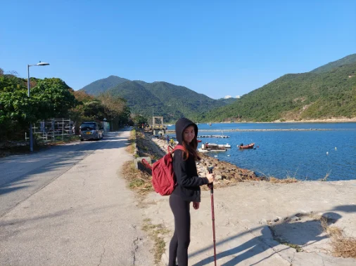
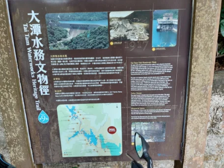
Tai Tam Waterworks Heritage Trail
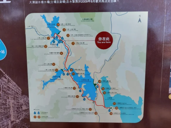
In the Tai Tam Country Park area, there are a total of 21 historic waterworks structures and 10 trail stations. It takes less than 1 hour (not counting the photo time) to complete it. For the details of the route, you can refer to the map below.
Or you can check out the HK government water supplies department website to download the pdf where all icons are there with narrative.
There are notice boards near each icon with narratives, so you can know each of the icons in detail if you want to there.
How to get to Tai Tam Reservoir
There are two main ways for you to get to Tai Tam Reservoir namely on foot or by public transport.
Public Transport to Tai Tam Reservoir
The easiest way to get to the Tai Tam Reservoir is to take bus number 14 by Hong Kong Citybus). Then get off at Tai Tam Reservoir (North station). From there, you can take the signature dam photo from the bottom first and then explore other reservoirs according to the map.
The MTR for going to Tai Tam is to get off at either “Sai Wan Ho” or “Sau Kei Wan” station then take the number 14 bus (toward Stanley Fort (Gate) / Ma Hang). The bus ride is around 30 minutes.
For details of the route and timetable, go to the Citybus website and search number 14.
Alternatively, you can take a minibus number 16x (Toward Stanley Village) to Tai Tam Country Park. The departure station is near MTR “Chai Wan” Exit C. You can check the minimum van timetable and frequency here .
However, I recommend you choose the number 14 bus over the mini-van. Mainly because you will need to request the driver to drop you off at Tai Tam Country Park in advance. And it is hard for you to request the precise drop-off point as a foreigner.
Hike to the Tai Tam Reservoir via Tai Tam Reservoir Road(from Admiralty)
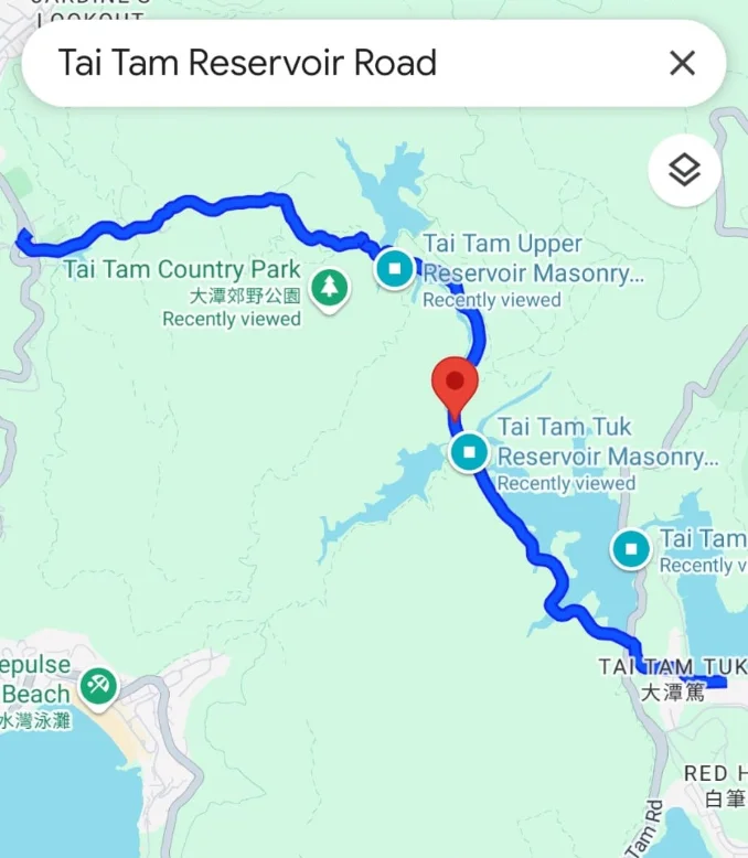
The easiest route to hike to Tai Tam Reservoir is starting on the Tai Tam Reservoir Road. All you need to do is just to type “Tai Tam Reservoir Rd” on Google Maps and it shall pop up.
The starting point is from Wong Nai Chung Reservoir Park with the endpoint at Tai Tam Country Park South Entrance (where the Number 14 bus is available).
To get to Wong Nai Chung Reservoir, simply take bus number 6 from “Admiralty” MTR station.
This route takes you around 2.5 hours and all the roads are flat. It is classified as very easy.
So it is suitable for family walks and even with pets.

Hike to the Tai Tam Reservoir via Tai Tam Reservoir Road(from Quarrybay / Tai Koo)
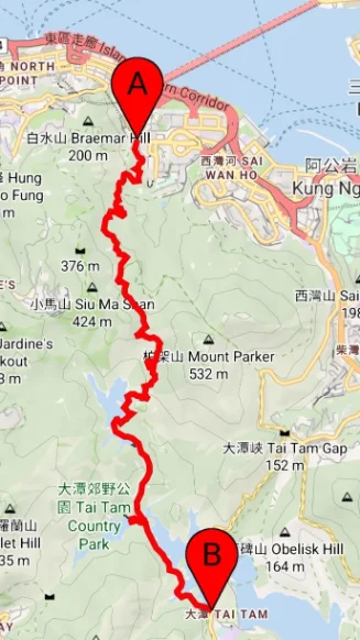
Want to feel more like hiking? There is a more scenic route starting from Mount Park Road (near Quarry Bay public library).
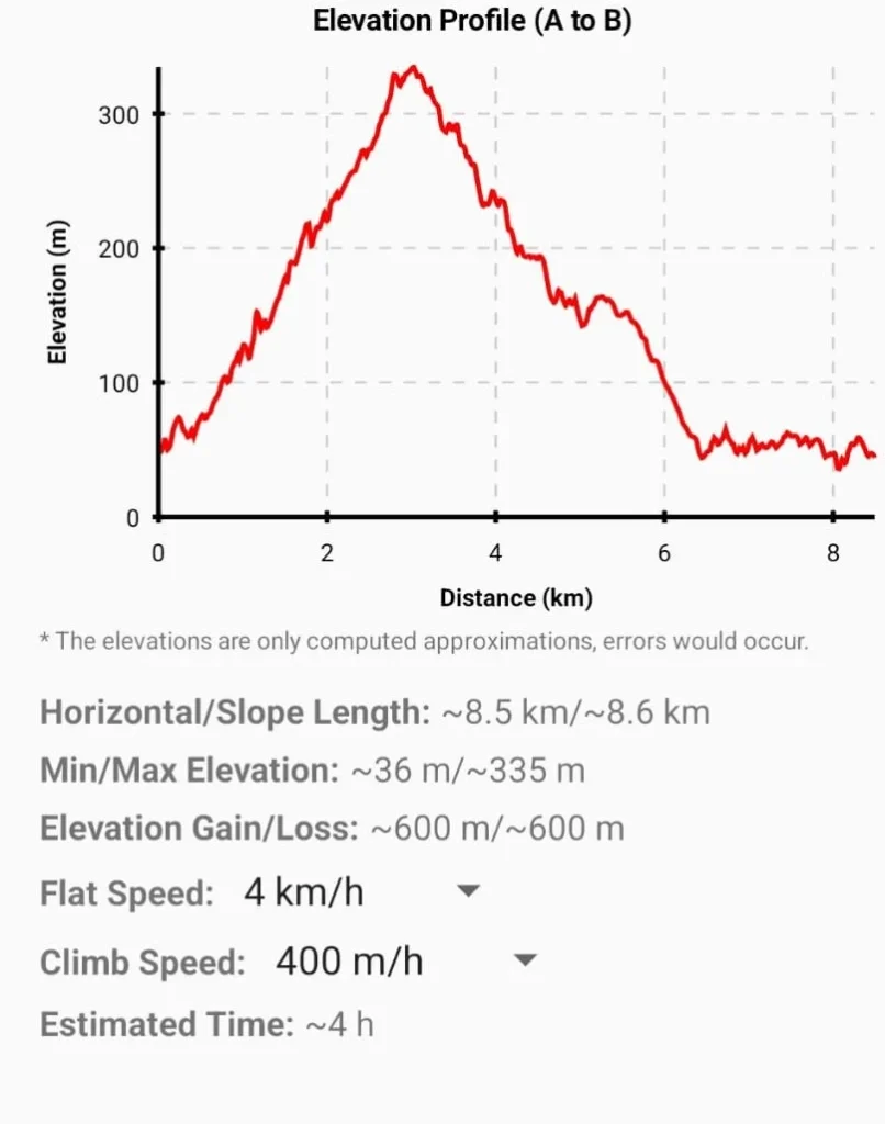
From there you will take Mount Parker Road, hiking to Mount Butler (435m) & Quarry Gap (320m). Then enter from Tai Tam Upper Reservoir, passing through Tai Tam Byewash Reservoir, Tai Tam Intermediate Reservoir, and exiting at Tai Tam Reservoir (the South Park entrance)>
The evaluation profile for the route is from 100m to 400m and going back to 100m. The distance is around 8.5km and the estimated hiking time is 4 hours.
Still, most of the roads are well-established and the map can be plotted even via Google Maps. So it is one of the best family walk routes that you can soak into nature while challenging a bit on yourself.
To get to the starting point, you can either walk there from “Quarry Bay” MTR Station A exit or “Tai Koo” MTR Station B exit. You can also find some good Hong Kong street food near both MTR stations.
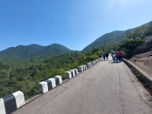
For a detailed route, you can also download the Mount Parker Road to Tai Tam Reservoir GPX here on my share drive or refer to the below images.
Exiting from Tai Tam Reservoir
Once you are done with the Tai Tam Reservoir, you can either take the public transport mentioned back or take another route to hike.
If you choose hiking, remember to ensure you get to the city before dawn.
If you are taking public transport, you can either get back to the city center or head to Stanley Village which is another famous icon in Hong Kong. Or if you exit at Quarry Bay, you can take the MTR to other attractions like Old Town Central (Sheung Wan) and Mong Kok.
Is it safe to hike to Tai Tam Reservoir?
As mentioned, the route to Tai Tam is very easy. I would give 2 out of 10 for the difficulty score especially if you are taking the Tai Tam Reservoir road directly. Unlike other trails like the Sharp Peak which would require some level of fitness, Tai Tam is for everyone.
So it is very safe for a family hike. Remember always bring enough water and food supply. 2 Liter water per person is recommended.
I hope my experience can help you to plan your visit to Tai Tam. Please feel free to leave me a comment for any inquiry. I love travel and also hiking in Hong Kong. Hong Kong is my hometown so it is my pleasure to help.

